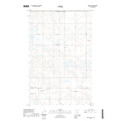
2020 Map of Lone Tree Lake
USGS Topo · Published 2020About this map
Comertown sits at the intersection of rural life and the expansive prairie of Sheridan County, Montana, just south of the border with the United States of America. This landscape is characterized by a dense network of glacial depressions and wetlands, most notably Widgeon Slough and Larson Slough, which dictate the winding path of section-line roads like Ueland Rd and McElroy Rd. The map reveals a deeply rooted community structure through its scattered burial grounds, including Our Saviors Cem in the northeast and Lone Tree Cem near the center of the township.
Find a feature on this map
18 named features on this map. Tap any name to fly to it.
Don’t see what you’re looking for? This feature index may not catch every label — zoom into the map to look around manually.
Map Details
Editions of this 2020 Lone Tree Lake Map
This is the sole edition of this map. No revisions or reprints were ever made.
Other maps of this area

1954 · Wolf Point
USGS Topo · 1:250,000

1958 · Wolf Point
USGS Topo · 1:250,000

1983 · Tadpole Lake
USGS Topo · 1:24,000

1983 · Dooley SE
USGS Topo · 1:24,000

1983 · Lone Tree Lake
USGS Topo · 1:24,000

1983 · Park Lake
USGS Topo · 1:24,000

1983 · Westby South
USGS Topo · 1:24,000

1983 · Westby North
USGS Topo · 1:24,000
2011 · Dooley SE
USGS Topo · 1:24,000
2011 · Lone Tree Lake
USGS Topo · 1:24,000