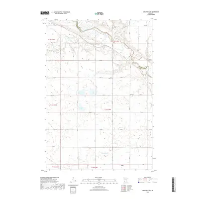
2019 Map of Lone Tree Lake
USGS Topo · Published 2019About this map
The Minnesota River and its confluence with the Yellow Medicine River define the northern landscape of this agricultural region. The terrain is marked by a network of drainage features including Hawk Cr, Wood Lake Cr, and Boiling Spring Cr, which flow toward the river valley. The township organization is clear through the rectilinear road system, with family and community history preserved at Rock Valley Cem and Hillside Cem. In the southern portion of the sheet, the settlement of Echo sits near the border of t113n r38w. Several small bodies of water, such as Lone Tree Lake, Highbank Lake, and Kvistid Lake, are scattered across the central plains, representing the glaciated prairie potholes typical of this part of Minnesota. The map also documents the boundary line between Renville Co and Yellow Medicine Co as it follows the river's winding course.
Find a feature on this map
52 named features on this map. Tap any name to fly to it.
Don’t see what you’re looking for? This feature index may not catch every label — zoom into the map to look around manually.
Map Details
Editions of this 2019 Lone Tree Lake Map
This is the sole edition of this map. No revisions or reprints were ever made.
Other maps of this area

1953 · New Ulm
USGS Topo · 1:250,000

1957 · New Ulm
USGS Topo · 1:250,000

1958 · New Ulm
USGS Topo · 1:250,000

1962 · School Grove Lake
USGS Topo · 1:24,000

1962 · Wood Lake
USGS Topo · 1:24,000

1965 · Echo
USGS Topo · 1:24,000

1965 · Lone Tree Lake
USGS Topo · 1:24,000

1965 · Belview
USGS Topo · 1:24,000

1965 · Iverson Lake
USGS Topo · 1:24,000

1965 · Sacred Heart
USGS Topo · 1:24,000