
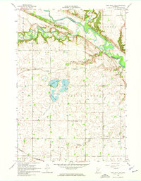
1965 Map of Lone Tree Lake
USGS Topo · Published 1966About this map
The Minnesota River valley carves a deep, forested path through the prairies of Yellow Medicine County and Renville County in this mid-1960s survey. This specific stretch of river is defined by the Upper Sioux Agency State Park, an area of significant historical interaction between the Dakota people and the United States government. Just south of the bluffs, the Wood Lake State Monument marks the site of the 1862 conflict that occurred on this undulating landscape.
Find a feature on this map
27 named features on this map. Tap any name to fly to it.
Don’t see what you’re looking for? This feature index may not catch every label — zoom into the map to look around manually.
Map Details
Editions of this 1965 Lone Tree Lake Map
2 editions found
Other maps of this area

1953 · New Ulm
USGS Topo · 1:250,000

1957 · New Ulm
USGS Topo · 1:250,000

1958 · New Ulm
USGS Topo · 1:250,000

1962 · School Grove Lake
USGS Topo · 1:24,000

1962 · Wood Lake
USGS Topo · 1:24,000

1965 · Echo
USGS Topo · 1:24,000

1965 · Belview
USGS Topo · 1:24,000

1965 · Iverson Lake
USGS Topo · 1:24,000

1965 · Sacred Heart
USGS Topo · 1:24,000
1965 · Granite Falls
USGS Topo · 1:24,000