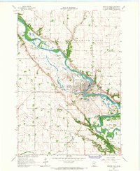
1965 Map of Granite Falls
USGS Topo · Published 1967About this map
The Minnesota River carves a winding path through this mid-1960s landscape, defining the border between Chippewa and Yellow Medicine counties. The town of Granite Falls serves as the central hub, where the Chicago Milwaukee St Paul and Pacific and Great Northern railroads intersect near the river's bend. This era shows a community deeply tied to the valley, with numerous gravel pits and a Quarry indicating active local industry along the banks.
Find a feature on this map
40 named features on this map. Tap any name to fly to it.
Don’t see what you’re looking for? This feature index may not catch every label — zoom into the map to look around manually.
Map Details
Editions of this 1965 Granite Falls Map
This is the sole edition of this map. No revisions or reprints were ever made.
Other maps of this area

1953 · New Ulm
USGS Topo · 1:250,000

1957 · New Ulm
USGS Topo · 1:250,000

1958 · New Ulm
USGS Topo · 1:250,000

1962 · Wood Lake NW
USGS Topo · 1:24,000

1962 · Wood Lake
USGS Topo · 1:24,000

1965 · Montevideo
USGS Topo · 1:24,000

1965 · Lone Tree Lake
USGS Topo · 1:24,000

1965 · Asbury
USGS Topo · 1:24,000

1965 · Hazel Run
USGS Topo · 1:24,000
1965 · Maynard
USGS Topo · 1:24,000