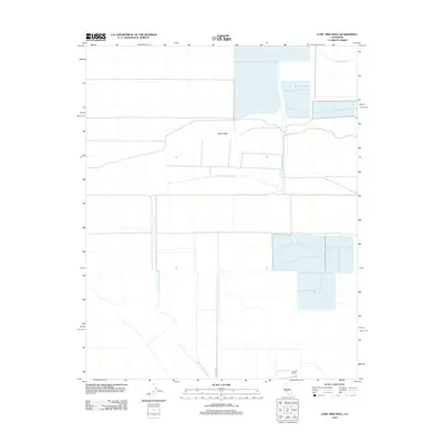
2012 Map of Lone Tree Well
USGS Topo · Published 2012About this map
Sand Ridge rises within this dry California landscape, where complex water management systems define the local geography. The area is marked by significant hydrological infrastructure, including the Homeland Canal, the controlled Kern River Channel, and the Hacienda Spillway, which together shape the region's agricultural potential. In the south, the namesake Lone Tree Well sits near the Burhans Ranch, illustrating the sparse but critical settlement patterns that rely on deep-water access in the Tulare Lake Basin. The map records a grid of access roads, primarily anchored by Lost Hills Rd, which connect the industrial-scale farming operations and irrigation plots that cover much of the terrain.
Find a feature on this map
7 named features on this map. Tap any name to fly to it.
Don’t see what you’re looking for? This feature index may not catch every label — zoom into the map to look around manually.
Map Details
Editions of this 2012 Lone Tree Well Map
This is the sole edition of this map. No revisions or reprints were ever made.
Other maps of this area

1914 · Lost Hills
USGS Topo · 1:125,000

1929 · Hacienda Ranch
USGS Topo · 1:31,680

1929 · West Alpaugh
USGS Topo · 1:31,680

1930 · Miramonte Ranch
USGS Topo · 1:31,680

1931 · Harvester
USGS Topo · 1:31,680

1932 · Dudley Ridge
USGS Topo · 1:31,680

1932 · Antelope Plain
USGS Topo · 1:31,680

1932 · Reynolds Ranch
USGS Topo · 1:31,680

1932 · West Camp
USGS Topo · 1:31,680

1932 · Lone Tree Well
USGS Topo · 1:31,680