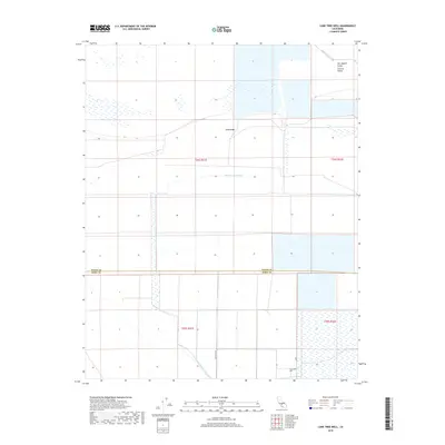
2018 Map of Lone Tree Well
USGS Topo · Published 2018About this map
The San Joaquin Valley landscape across the Kings and Kern County line is defined by the managed flow of water through an arid terrain. The Kern River Channel and the Homeland Canal provide the hydraulic infrastructure necessary for the region's agricultural footprint. This 2018 survey illustrates the systematic grid of the Public Land Survey System, highlighting the transition between the Central Valley floor and subtle elevation changes like the Sand Ridge. The namesake Lone Tree Well remains a primary landmark in the southern reaches of the map, situated near the intersection of Lost Hills Rd and Line A. This map provides a detailed view of the water-management corridors that sustain this section of the valley, showing how man-made channels intersect with natural drainage patterns.
Find a feature on this map
13 named features on this map. Tap any name to fly to it.
Don’t see what you’re looking for? This feature index may not catch every label — zoom into the map to look around manually.
Map Details
Editions of this 2018 Lone Tree Well Map
This is the sole edition of this map. No revisions or reprints were ever made.
Other maps of this area

1914 · Lost Hills
USGS Topo · 1:125,000

1929 · Hacienda Ranch
USGS Topo · 1:31,680

1929 · West Alpaugh
USGS Topo · 1:31,680

1930 · Miramonte Ranch
USGS Topo · 1:31,680

1931 · Harvester
USGS Topo · 1:31,680

1932 · Dudley Ridge
USGS Topo · 1:31,680

1932 · Antelope Plain
USGS Topo · 1:31,680

1932 · Reynolds Ranch
USGS Topo · 1:31,680

1932 · West Camp
USGS Topo · 1:31,680

1932 · Lone Tree Well
USGS Topo · 1:31,680