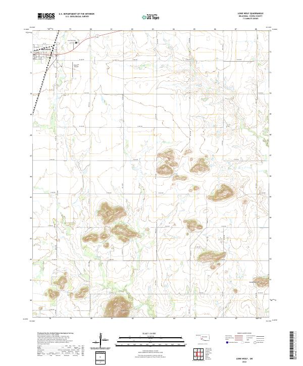
2022 Map of Lone Wolf
USGS Topo · Published 2022About this map
Lone Wolf anchors the northwest corner of this Kiowa County landscape, where the residential grid of streets like Main St and 1st St gives way to a vast network of section-line roads. The terrain is defined by isolated elevations rising from the plains, most notably Tepee Mtn in the south and Camelback Mtn near the eastern boundary. These landmarks, alongside the winding course of Tepee Cr, provide a distinct sense of place for researchers tracing family history in the area. Just northeast of the town center, the Lone Wolf Cem and the Hohman Airport represent key local sites of civic and economic importance. The map clearly illustrates the transition from the organized settlement of Lone Wolf into the surrounding agricultural landscape, partitioned by roads such as E1400 Rd and N2100 Rd.
Find a feature on this map
33 named features on this map. Tap any name to fly to it.
Don’t see what you’re looking for? This feature index may not catch every label — zoom into the map to look around manually.
Map Details
Editions of this 2022 Lone Wolf Map
This is the sole edition of this map. No revisions or reprints were ever made.
Other maps of this area

1955 · Lawton
USGS Topo · 1:250,000

1955 · Clinton
USGS Topo · 1:250,000

1957 · Clinton
USGS Topo · 1:250,000

1961 · Hobart
USGS Topo · 1:62,500

1961 · Retrop
USGS Topo · 1:62,500

1963 · Babbs
USGS Topo · 1:24,000

1964 · Lone Wolf
USGS Topo · 1:24,000

1964 · Warren
USGS Topo · 1:24,000
1964 · Roosevelt
USGS Topo · 1:24,000

1971 · Blair
USGS Topo · 1:24,000