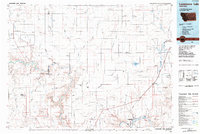
1984 Map of Lonesome Lake
USGS Topo · Published 1984About this map
Big Sandy and the surrounding plains of north-central Montana appear in this 1984 study, defined by an intricate network of coulees draining toward the Marias River and the Missouri River. The landscape is dominated by dry-land drainage features such as Sixmile Coulee, Fourteenmile Coulee, and Twelvemile Coulee, which carve through the high terrain between the major river valleys. The Burlington Northern railroad corridor serves as the primary industrial artery, linking settlements like Verona and Kenilworth to the regional trade network.
Find a feature on this map
67 named features on this map. Tap any name to fly to it.
Don’t see what you’re looking for? This feature index may not catch every label — zoom into the map to look around manually.
Map Details
Editions of this 1984 Lonesome Lake Map
This is the sole edition of this map. No revisions or reprints were ever made.
Other maps of this area

1886 · Great Falls
USGS Topo · 1:250,000

1890 · Fort Benton
USGS Topo · 1:250,000

1892 · Fort Benton
USGS Topo · 1:250,000

1897 · Fort Benton
USGS Topo · 1:250,000

1904 · Assinniboine
USGS Topo · 1:62,500

1904 · Boxelder
USGS Topo · 1:62,500

1906 · Kremlin
USGS Topo · 1:62,500

1906 · Lonesome
USGS Topo · 1:62,500

1906 · Boxelder
USGS Topo · 1:62,500

1912 · Thibedeau Lake
USGS Topo · 1:125,000
Featured Places
- Big Sandy, MT
- Kenilworth, MT
- Hidden Valley Hutterite Colony, MT
- Rocky Crossing, MT
- Meadow Lane Hutterite Colony, MT