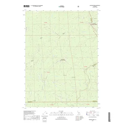
2018 Map of Lonesome Ridge
USGS Topo · Published 2018About this map
Lonesome Ridge serves as the central spine of this landscape in the northern California wilderness, where the borders of Humboldt, Siskiyou, and Del Norte counties converge. This high-country terrain is defined by a dense network of drainages within the Six Rivers National Forest and Klamath National Forest. Water is a defining element of the geography, ranging from the high elevations of Deer Lick Lake and Onion Lake to the significant flow of Bluff Cr and its various forks. Access to this isolated region is limited to remote forest routes, such as Forest Rte 14N02 and Cedar Camp Rd, which navigate between prominent gulches like Woodtick Gulch and Soapstone Gulch. The map records a moment in the 21st century where the primary human footprint is concentrated on fire management and resource access via these winding forest roads.
Find a feature on this map
38 named features on this map. Tap any name to fly to it.
Don’t see what you’re looking for? This feature index may not catch every label — zoom into the map to look around manually.
Map Details
Editions of this 2018 Lonesome Ridge Map
This is the sole edition of this map. No revisions or reprints were ever made.
Other maps of this area

1922 · Preston Peak
USGS Topo · 1:125,000

1925 · Hoopa
USGS Topo · 1:125,000

1945 · Ship Mountain
USGS Topo · 1:62,500

1945 · Tectah Creek
USGS Topo · 1:62,500

1948 · Weed
USGS Topo · 1:250,000

1950 · Weed
USGS Topo · 1:250,000

1952 · Ship Mountain
USGS Topo · 1:62,500

1952 · Orleans
USGS Topo · 1:62,500

1952 · Tectah Creek
USGS Topo · 1:62,500

1955 · Dillon Mtn
USGS Topo · 1:62,500