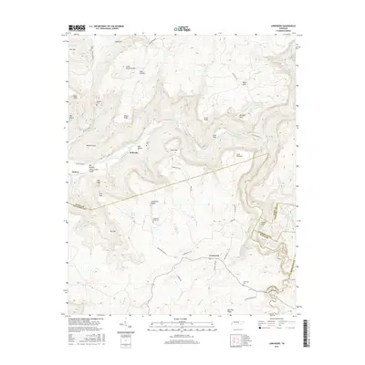
2016 Map of Lonewood
USGS Topo · Published 2016About this map
Lonewood and the surrounding plateau of the eastern Highland Rim are defined by a complex network of canyons and subterranean drainage. The Caney Fork river cuts a deep path through the center of the sheet, creating landmarks like the Big Bottom Caney Creek Gulch and Scott Gulf. Significant geological features such as Virgin Falls, Big Sink, and Hell Hole suggest a classic karst landscape where surface water frequently disappears into the limestone below. Local history is anchored by family burial grounds and small community centers, including Lonewood Cem, Graveyard Ridge Cem, and the settlement of Bethesda. The terrain is further marked by high points like Scott Pinnacle and Welch Knob, while a web of local roads such as Flowing Well Rd and Scott Gulf Rd provide access through the hollows and along the ridges of the Van Buren and White County border.
Find a feature on this map
73 named features on this map. Tap any name to fly to it.
Don’t see what you’re looking for? This feature index may not catch every label — zoom into the map to look around manually.
Map Details
Editions of this 2016 Lonewood Map
This is the sole edition of this map. No revisions or reprints were ever made.
Other maps of this area

1892 · Pikeville
USGS Topo · 1:125,000

1895 · Pikeville
USGS Topo · 1:125,000

1909 · Sequatchie Valley
USGS Topo · 1:62,500

1910 · Pikeville
USGS Topo · 1:62,500

1912 · Crossville
USGS Topo · 1:62,500

1935 · Billingsley Gap
USGS Topo · 1:24,000

1943 · Cookeville
USGS Topo · 1:100,000

1944 · Cookeville
USGS Topo · 1:100,000

1953 · Chattanooga
USGS Topo · 1:250,000

1954 · De Rossett
USGS Topo · 1:24,000