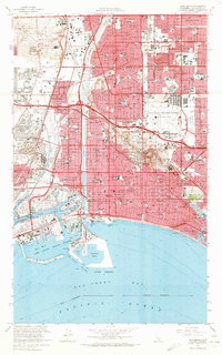
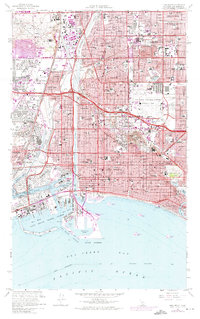
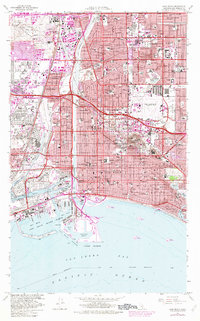
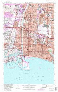
1964 Map of Long Beach
USGS Topo · Published 1966About this map
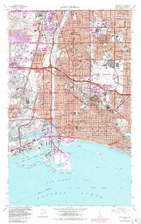
The Long Beach waterfront and its industrial skyline define this mid-1960s study, showcasing an era when the Wilmington Oil Field and Long Beach Oil Field were primary drivers of the local economy. The landscape is dominated by the channelized Los Angeles River and the complex harbor system, including the Inner Harbor and Southeast Basin. To the north, the post-war suburban expansion of Lakewood and Bixby Knolls is fully realized, serviced by a burgeoning network of schools like Lakewood High Sch and Long Beach State College. The map reveals the heavy presence of the US Naval Reservation alongside the recreational infrastructure of Marine Stadium and the Lakewood Golf Course. Residential patterns in neighborhoods like Belmont Shore and the canal-lined Naples contrast sharply with the industrial grid of Wilmington and the massive rail infrastructure of the Union Pacific and Southern Pacific lines.
Find a feature on this map
179 named features on this map. Tap any name to fly to it.
Don’t see what you’re looking for? This feature index may not catch every label — zoom into the map to look around manually.
Map Details
Editions of this 1964 Long Beach Map
5 editions found
Other maps of this area

1896 · Redondo
USGS Topo · 1:62,500

1896 · Las Bolsas
USGS Topo · 1:62,500

1896 · San Pedro
USGS Topo · 1:62,500

1896 · Downey
USGS Topo · 1:62,500

1899 · Downey
USGS Topo · 1:62,500

1901 · Southern California Sheet No. 1
USGS Topo · 1:250,000

1902 · Downey
USGS Topo · 1:62,500

1904 · Southern California Sheet No. 1
USGS Topo · 1:250,000

1923 · Wilmington
USGS Topo · 1:24,000

1924 · Compton
USGS Topo · 1:24,000