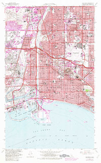
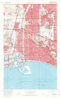
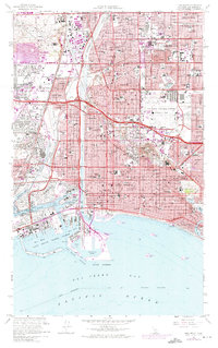
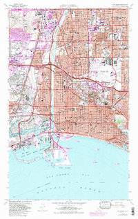
1964 Map of Long Beach
USGS Topo · Published 1982About this map
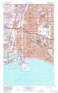
The industrial and coastal landscape of Long Beach is dominated by the massive operations of the Wilmington Oil Field and Dominguez Oil Field, which underscore the region's mid-century economic foundation. In this era, the Los Angeles River cuts a channel between growing residential tracts and the complex maritime infrastructure of the Inner Harbor and West Basin. While neighborhoods like Bixby Knolls and California Heights represent suburban expansion, the map also captures the distinct layouts of the waterfront communities of Belmont Shore and the canal-linked Naples.
Find a feature on this map
109 named features on this map. Tap any name to fly to it.
Don’t see what you’re looking for? This feature index may not catch every label — zoom into the map to look around manually.
Map Details
Editions of this 1964 Long Beach Map
5 editions found
Other maps of this area

1896 · Redondo
USGS Topo · 1:62,500

1896 · Las Bolsas
USGS Topo · 1:62,500

1896 · San Pedro
USGS Topo · 1:62,500

1896 · Downey
USGS Topo · 1:62,500

1899 · Downey
USGS Topo · 1:62,500

1901 · Southern California Sheet No. 1
USGS Topo · 1:250,000

1902 · Downey
USGS Topo · 1:62,500

1904 · Southern California Sheet No. 1
USGS Topo · 1:250,000

1923 · Wilmington
USGS Topo · 1:24,000

1924 · Compton
USGS Topo · 1:24,000