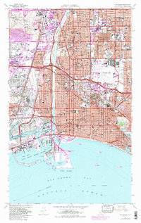
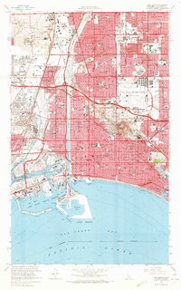
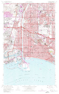
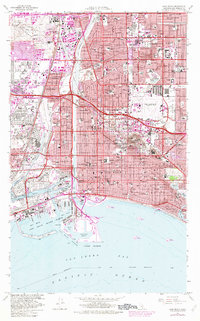
1964 Map of Long Beach
USGS Topo · Published 1987About this map
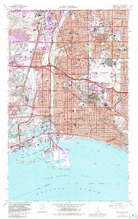
The Queen Mary sits berthed in the Long Beach Channel, serving as a permanent landmark at the edge of a massive maritime and industrial landscape. This mid-century survey captures Long Beach and its neighbors during a period of intense urban expansion, where the grid of residential neighborhoods like Bixby Knolls and Los Altos pushes against the vast infrastructure of the U S Naval Shipyard and the Inner Harbor. The influence of the petroleum industry is unmistakable, with Oil Field derricks and Oil Refinery tanks dotting the landscape from Dominguez Hills to the famous heights of Signal Hill.
Find a feature on this map
131 named features on this map. Tap any name to fly to it.
Don’t see what you’re looking for? This feature index may not catch every label — zoom into the map to look around manually.
Map Details
Editions of this 1964 Long Beach Map
5 editions found
Other maps of this area

1896 · Redondo
USGS Topo · 1:62,500

1896 · Las Bolsas
USGS Topo · 1:62,500

1896 · San Pedro
USGS Topo · 1:62,500

1896 · Downey
USGS Topo · 1:62,500

1899 · Downey
USGS Topo · 1:62,500

1901 · Southern California Sheet No. 1
USGS Topo · 1:250,000

1902 · Downey
USGS Topo · 1:62,500

1904 · Southern California Sheet No. 1
USGS Topo · 1:250,000

1923 · Wilmington
USGS Topo · 1:24,000

1924 · Compton
USGS Topo · 1:24,000