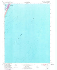
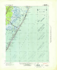
1951 Map of Long Beach NE
USGS Topo · Published 1973About this map
Barnegat Light sits at the northern tip of Long Beach, marking the critical junction between the inlet and the open sea. This 1951 survey, with 1972 revisions, captures the thin coastal ribbon of Barnegat Light Boro Bdy as it transitions from the maritime settlement at the point down to Long Beach Park. The map is dominated by the vast expanse of the Atlantic Ocean and the interior waters of Barnegat Bay, illustrating the precarious nature of the barrier island's geography. To the west of the main beach, Vol Sedge appears as a distinct marshy feature within the bay. The map provides a look at the residential expansion of the early 1970s, shown in purple tint, contrasting with the mid-century shoreline and original settlement footprints.
Find a feature on this map
7 named features on this map. Tap any name to fly to it.
Don’t see what you’re looking for? This feature index may not catch every label — zoom into the map to look around manually.
Map Details
Editions of this 1951 Long Beach NE Map
4 editions found
Other maps of this area

1888 · Barnegat
USGS Topo · 1:62,500

1888 · Long Beach
USGS Topo · 1:62,500

1893 · Long Beach
USGS Topo · 1:62,500

1893 · Barnegat
USGS Topo · 1:62,500

1898 · Barnegat
USGS Topo · 1:62,500

1919 · Long Beach
USGS Topo · 1:62,500

1919 · Barnegat
USGS Topo · 1:62,500

1941 · Toms River
USGS Topo · 1:62,500
1941 · Long Beach
USGS Topo · 1:62,500

1946 · Wilmington
USGS Topo · 1:250,000