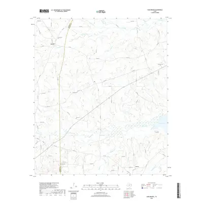
2019 Map of Long Branch
USGS Topo · Published 2019About this map
Lake Murvaul dominates the southeastern portion of this landscape where the Rusk Co and Panola Co line meets. The terrain is a complex network of wetlands and creek bottoms, where the waters of Murvaul Cr and Irons Bayou feed into the lake. This 2019 survey shows the rural character of the region, anchored by the settlements of Pinehill in the northwest and Dotson in the south.
Find a feature on this map
82 named features on this map. Tap any name to fly to it.
Don’t see what you’re looking for? This feature index may not catch every label — zoom into the map to look around manually.
Map Details
Editions of this 2019 Long Branch Map
This is the sole edition of this map. No revisions or reprints were ever made.
Other maps of this area

1953 · Palestine
USGS Topo · 1:250,000

1956 · Tyler
USGS Topo · 1:250,000

1957 · Palestine
USGS Topo · 1:250,000

1958 · Timpson
USGS Topo · 1:62,500

1958 · Carthage
USGS Topo · 1:62,500

1960 · Minden
USGS Topo · 1:62,500

1960 · Mount Enterprise
USGS Topo · 1:62,500
1983 · Church Hill
USGS Topo · 1:24,000

1983 · Long Branch
USGS Topo · 1:24,000

1983 · Fair Play
USGS Topo · 1:24,000