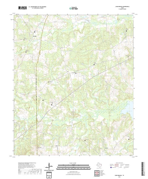
2022 Map of Long Branch
USGS Topo · Published 2022About this map
Pinehill and Dotson serve as the primary anchors for this rural landscape along the boundary of Rusk and Panola counties. The terrain is defined by a dense network of watercourses, including the wide path of Irons Bayou and the southeastern reach of Lake Murvaul. This area is particularly rich in family and community burial sites, suggesting a deeply rooted genealogy in East Texas. Numerous cemeteries, such as Long Branch Cem and Boynton Cem, are scattered across the timbered uplands and creek bottoms.
Find a feature on this map
88 named features on this map. Tap any name to fly to it.
Don’t see what you’re looking for? This feature index may not catch every label — zoom into the map to look around manually.
Map Details
Editions of this 2022 Long Branch Map
This is the sole edition of this map. No revisions or reprints were ever made.
Other maps of this area

1953 · Palestine
USGS Topo · 1:250,000

1956 · Tyler
USGS Topo · 1:250,000

1957 · Palestine
USGS Topo · 1:250,000

1958 · Timpson
USGS Topo · 1:62,500

1958 · Carthage
USGS Topo · 1:62,500

1960 · Minden
USGS Topo · 1:62,500

1960 · Mount Enterprise
USGS Topo · 1:62,500
1983 · Church Hill
USGS Topo · 1:24,000

1983 · Long Branch
USGS Topo · 1:24,000

1983 · Fair Play
USGS Topo · 1:24,000