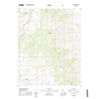
2018 Map of Long Canyon
USGS Topo · Published 2018About this map
Kennedy Meadows serves as a primary access point for the high Sierra high country, marking a transition between the Sequoia National Forest and the Inyo National Forest. This 2018 survey details the complex topography of the Sierra Nevada, where the South Fork Kern River flows through a landscape defined by deep drainages like Long Canyon and Tunawee Canyon. The transportation network is a mix of high-altitude roads such as Sherman Pass Rd and Ponderosa Rd, alongside iconic wilderness paths. Most notably, the Pacific Crest National Scenic Trail winds through the northwestern section, while the Long Canyon Trl offers a interior route through the forest. Water sources remain critical in this environment, with locations like Windy Springs, Willow Spring, and Clover Meadow distributed across the varying elevations of the quadrangle.
Find a feature on this map
34 named features on this map. Tap any name to fly to it.
Don’t see what you’re looking for? This feature index may not catch every label — zoom into the map to look around manually.
Map Details
Editions of this 2018 Long Canyon Map
This is the sole edition of this map. No revisions or reprints were ever made.
Other maps of this area

1905 · Olancha
USGS Topo · 1:125,000

1906 · Kernville
USGS Topo · 1:125,000

1907 · Olancha
USGS Topo · 1:125,000

1908 · Kernville
USGS Topo · 1:125,000

1908 · Ballarat
USGS Topo · 1:250,000

1913 · Ballarat
USGS Topo · 1:250,000

1915 · Searles Lake
USGS Topo · 1:250,000

1947 · Trona
USGS Topo · 1:250,000

1948 · Trona
USGS Topo · 1:250,000

1948 · Death Valley
USGS Topo · 1:250,000