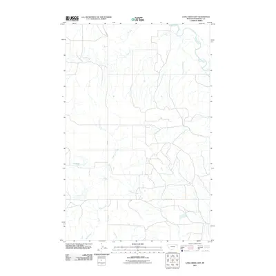
2011 Map of Long Creek East
USGS Topo · Published 2011About this map
The Poplar River carves a winding path through the northeast corner of this Roosevelt County landscape, anchoring a complex drainage system that defines the local topography. This 2011 survey illustrates a sparse network of watercourses and rural corridors, where Long Creek and Culbertson Creek meander across the plains toward their eventual confluence. The presence of Horseshoe Lake suggests the historical shifting of these channels over time.
Find a feature on this map
8 named features on this map. Tap any name to fly to it.
Don’t see what you’re looking for? This feature index may not catch every label — zoom into the map to look around manually.
Map Details
Editions of this 2011 Long Creek East Map
This is the sole edition of this map. No revisions or reprints were ever made.
Other maps of this area

1910 · Cuskers
USGS Topo · 1:62,500

1912 · Chelsea
USGS Topo · 1:62,500

1912 · Hay Creek
USGS Topo · 1:62,500

1912 · Poplar
USGS Topo · 1:62,500

1915 · Cuskers
USGS Topo · 1:62,500

1954 · Wolf Point
USGS Topo · 1:250,000

1958 · Wolf Point
USGS Topo · 1:250,000

1972 · Chelsea
USGS Topo · 1:24,000

1972 · Poplar NE
USGS Topo · 1:24,000
1972 · Badger Creek
USGS Topo · 1:24,000