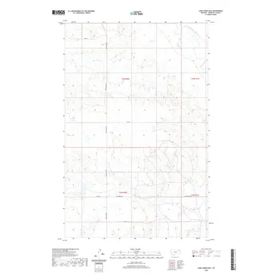
2020 Map of Long Creek East
USGS Topo · Published 2020About this map
Poplar River winds through the northeast corner of this high plains landscape, while Culbertson Cr and its tributaries carve intricate drainage patterns across the southern sections. This modern digital survey reveals a vast, open topography characterized by intermittent watercourses like Long Cr, Badger Cr, and Flea Cr. The sparse human footprint is marked primarily by a grid of rural routes and specialized access roads, including Poplar River Rd and the distinctly named Empire Bridge Rd. The map illustrates the transition from the river valley bluffs to the higher plateaus, showing how modern transportation routes like Jo 1 Dr navigate the complex network of draws and ridges in this portion of Roosevelt County.
Find a feature on this map
15 named features on this map. Tap any name to fly to it.
Don’t see what you’re looking for? This feature index may not catch every label — zoom into the map to look around manually.
Map Details
Editions of this 2020 Long Creek East Map
This is the sole edition of this map. No revisions or reprints were ever made.
Other maps of this area

1910 · Cuskers
USGS Topo · 1:62,500

1912 · Chelsea
USGS Topo · 1:62,500

1912 · Hay Creek
USGS Topo · 1:62,500

1912 · Poplar
USGS Topo · 1:62,500

1915 · Cuskers
USGS Topo · 1:62,500

1954 · Wolf Point
USGS Topo · 1:250,000

1958 · Wolf Point
USGS Topo · 1:250,000

1972 · Chelsea
USGS Topo · 1:24,000

1972 · Poplar NE
USGS Topo · 1:24,000
1972 · Badger Creek
USGS Topo · 1:24,000