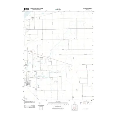
2012 Map of Long Creek
USGS Topo · Published 2012About this map
Mount Zion and the surrounding rural townships of Macon County appear in this 2012 survey, revealing a landscape defined by agricultural traditions and the expanding infrastructure of nearby Decatur. The southern reaches of Lake Decatur and the meandering course of Long Creek anchor the hydrology of the region, while the Norfolk Southern railroad line links small communities like Hervey City and Casner. This edition is particularly useful for genealogists, as it meticulously identifies local burial grounds including Ridge Cemetery, Florey Cemetery, and Point Pleasant Cemetery, often located near early settlement sites. The presence of Decatur Airport in the northwest corner highlights the modern transportation hub that shares the landscape with legacy locations such as Prairie Hall and the recreation grounds of Camp Warren along the banks of Big Creek.
Find a feature on this map
107 named features on this map. Tap any name to fly to it.
Don’t see what you’re looking for? This feature index may not catch every label — zoom into the map to look around manually.
Map Details
Editions of this 2012 Long Creek Map
This is the sole edition of this map. No revisions or reprints were ever made.
Other maps of this area

1929 · Decatur
USGS Topo · 1:62,500

1933 · Decatur
USGS Topo · 1:62,500

1935 · Sullivan
USGS Topo · 1:48,000

1940 · Sullivan
USGS Topo · 1:62,500

1949 · Dalton City
USGS Topo · 1:62,500

1955 · Bement
USGS Topo · 1:62,500

1958 · Decatur
USGS Topo · 1:250,000

1961 · Decatur
USGS Topo · 1:250,000

1967 · Long Creek
USGS Topo · 1:24,000
1967 · Argenta
USGS Topo · 1:24,000