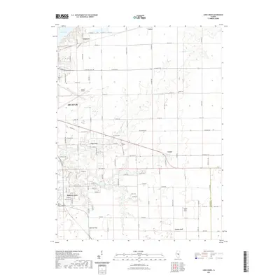
2021 Map of Long Creek
USGS Topo · Published 2021About this map
Lake Decatur and the eastern outskirts of Decatur define the northwestern corner of this central Illinois landscape. The terrain transitions from the developed corridors around Decatur Airport to a rural expanse punctuated by small communities like Casner and Prairie Hall. The map reveals a high density of rural burial sites, including North Fork Cem and Point Pleasant Cem, which provide specific points of interest for genealogical research in this portion of Macon County.
Find a feature on this map
53 named features on this map. Tap any name to fly to it.
Don’t see what you’re looking for? This feature index may not catch every label — zoom into the map to look around manually.
Map Details
Editions of this 2021 Long Creek Map
This is the sole edition of this map. No revisions or reprints were ever made.
Other maps of this area

1929 · Decatur
USGS Topo · 1:62,500

1933 · Decatur
USGS Topo · 1:62,500

1935 · Sullivan
USGS Topo · 1:48,000

1940 · Sullivan
USGS Topo · 1:62,500

1949 · Dalton City
USGS Topo · 1:62,500

1955 · Bement
USGS Topo · 1:62,500

1958 · Decatur
USGS Topo · 1:250,000

1961 · Decatur
USGS Topo · 1:250,000

1967 · Long Creek
USGS Topo · 1:24,000
1967 · Argenta
USGS Topo · 1:24,000