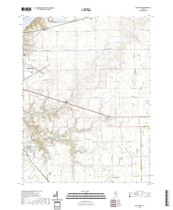
2024 Map of Long Creek
USGS Topo · Published 2024About this map
Lake Decatur and the eastern edge of Decatur anchor this central Illinois landscape, where the prairie transitions into the managed hydrology of the Sangamon river system. The terrain is a network of rural hamlets and agricultural infrastructure, connecting Oakley in the north to the junction at Hervey City and Prairie Hall in the south. Aviation is a prominent feature of the local economy, represented by the expansive Decatur Airport and the smaller Corman Acres Airport to the southeast.
Find a feature on this map
51 named features on this map. Tap any name to fly to it.
Don’t see what you’re looking for? This feature index may not catch every label — zoom into the map to look around manually.
Map Details
Editions of this 2024 Long Creek Map
This is the sole edition of this map. No revisions or reprints were ever made.
Historical Maps of Prairie Hall Through Time
3 maps found