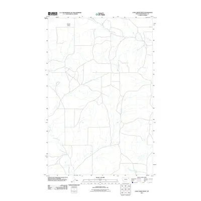
2011 Map of Long Creek West
USGS Topo · Published 2011About this map
Long Creek and its seasonal tributaries define this section of the Montana high plains within Roosevelt County. The landscape is characterized by intermittent drainages and a sprawling network of local ranching roads, including 2042 Rd in the northeast. A significant water management feature, Structure Number 124 Dam, sits along the northern edge of the map, illustrating the human efforts to manage resources in this arid environment. The southern portion of the quadrangle is marked by the winding paths of Boxelder Creek and Little Badger Creek, showcasing the natural erosion patterns and landform development of the Poplar District during the early 21st century.
Find a feature on this map
5 named features on this map. Tap any name to fly to it.
Don’t see what you’re looking for? This feature index may not catch every label — zoom into the map to look around manually.
Map Details
Editions of this 2011 Long Creek West Map
This is the sole edition of this map. No revisions or reprints were ever made.
Other maps of this area

1910 · Cuskers
USGS Topo · 1:62,500

1912 · Chelsea
USGS Topo · 1:62,500

1912 · Hay Creek
USGS Topo · 1:62,500

1912 · Poplar
USGS Topo · 1:62,500

1915 · Cuskers
USGS Topo · 1:62,500

1954 · Wolf Point
USGS Topo · 1:250,000

1958 · Wolf Point
USGS Topo · 1:250,000

1972 · Chelsea
USGS Topo · 1:24,000

1972 · Chelsea NW
USGS Topo · 1:24,000
1972 · Badger Creek
USGS Topo · 1:24,000