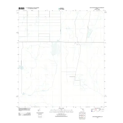
2012 Map of Long Island Marsh NE
USGS Topo · Published 2012About this map
Blue Head Ranch Airport sits as a lonely aviation marker in this corner of Highlands County, characterizing a landscape defined by expansive agriculture and water management. The drainage patterns of Cow Slough weave through the southern portion of the area, illustrating the essential relationship between the natural hydrology and the working ranchlands. Large-scale land divisions and geometric road structures, such as Coline Rd and SE Lake Browning Grade, reflect modern land use in a region where cattle ranching and vast open spaces remain the primary features. Along the eastern edge, Footman Trl provides a transit route through this specialized agricultural environment, where the grid-like precision of citrus groves or grazing tracts meets the meandering paths of native sloughs.
Find a feature on this map
5 named features on this map. Tap any name to fly to it.
Don’t see what you’re looking for? This feature index may not catch every label — zoom into the map to look around manually.
Map Details
Editions of this 2012 Long Island Marsh NE Map
This is the sole edition of this map. No revisions or reprints were ever made.
Other maps of this area

1953 · Lake June In Winter
USGS Topo · 1:24,000

1953 · Venus NW
USGS Topo · 1:24,000

1953 · Crewsville SE
USGS Topo · 1:24,000

1956 · Crewsville SW
USGS Topo · 1:24,000

1956 · Long Island Marsh SW
USGS Topo · 1:24,000

1956 · Fort Pierce
USGS Topo · 1:250,000

1957 · Long Island Marsh NW
USGS Topo · 1:24,000

1957 · Long Island Marsh SE
USGS Topo · 1:24,000

1957 · Venus SW
USGS Topo · 1:24,000

1957 · Long Island Marsh NE
USGS Topo · 1:24,000