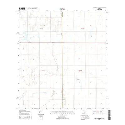
2015 Map of Long Island Marsh NE
USGS Topo · Published 2015About this map
The boundary between DeSoto and Highlands Counties bisects this Florida landscape, where agricultural drainage and remote transportation networks define the land use. The presence of the Blue Head Ranch Airport near the center of the sheet highlights the region's reliance on private aviation for managing large rural tracts. Natural water features like Split Lake and the meandering path of Cow Slough contrast with the rigid grid of the Public Land Survey System, particularly within the townships of t37s r27e and t38s r28e. Connectivity is provided by the east-west corridor of NE Highway 70 and the north-south Co Line Rd, which serve as the primary lifelines through this sparsely populated interior marshland.
Find a feature on this map
10 named features on this map. Tap any name to fly to it.
Don’t see what you’re looking for? This feature index may not catch every label — zoom into the map to look around manually.
Map Details
Editions of this 2015 Long Island Marsh NE Map
This is the sole edition of this map. No revisions or reprints were ever made.
Other maps of this area

1953 · Lake June In Winter
USGS Topo · 1:24,000

1953 · Venus NW
USGS Topo · 1:24,000

1953 · Crewsville SE
USGS Topo · 1:24,000

1956 · Crewsville SW
USGS Topo · 1:24,000

1956 · Long Island Marsh SW
USGS Topo · 1:24,000

1956 · Fort Pierce
USGS Topo · 1:250,000

1957 · Long Island Marsh NW
USGS Topo · 1:24,000

1957 · Long Island Marsh SE
USGS Topo · 1:24,000

1957 · Venus SW
USGS Topo · 1:24,000

1957 · Long Island Marsh NE
USGS Topo · 1:24,000