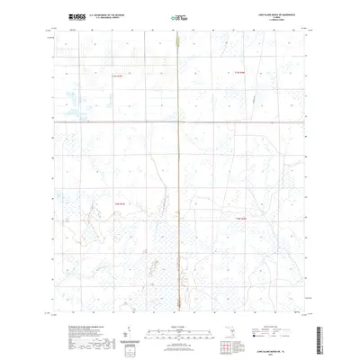
2021 Map of Long Island Marsh NE
USGS Topo · Published 2021About this map
Cow Slough winds through this interior Florida landscape at the boundary of Highlands and DeSoto counties. This 2021 update shows a region dominated by vast wetland signatures and water management features, including the shoreline of Split Lake in the west. The map provides a contemporary view of the Public Land Survey System (PLSS) layout, clearly demarcating the intersections of t37s r27e, t37s r28e, and t38s r28e. The presence of Footman Trl in the northeast quadrant suggests established access through the marshes, while the dense network of unnamed access roads and drainage channels illustrates the modern hydrological engineering necessary for agriculture and land use in the Florida scrub and marshland.
Find a feature on this map
8 named features on this map. Tap any name to fly to it.
Don’t see what you’re looking for? This feature index may not catch every label — zoom into the map to look around manually.
Map Details
Editions of this 2021 Long Island Marsh NE Map
This is the sole edition of this map. No revisions or reprints were ever made.
Other maps of this area

1953 · Lake June In Winter
USGS Topo · 1:24,000

1953 · Venus NW
USGS Topo · 1:24,000

1953 · Crewsville SE
USGS Topo · 1:24,000

1956 · Crewsville SW
USGS Topo · 1:24,000

1956 · Long Island Marsh SW
USGS Topo · 1:24,000

1956 · Fort Pierce
USGS Topo · 1:250,000

1957 · Long Island Marsh NW
USGS Topo · 1:24,000

1957 · Long Island Marsh SE
USGS Topo · 1:24,000

1957 · Venus SW
USGS Topo · 1:24,000

1957 · Long Island Marsh NE
USGS Topo · 1:24,000