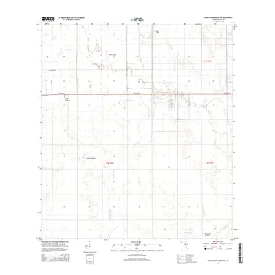
2015 Map of Long Island Marsh NW
USGS Topo · Published 2015About this map
The small settlement of Joshua sits at the intersection of local routes like Sargent Loop and NE Highway 70, serving as the primary human landmark in this section of DeSoto County. This 2015 survey reveals a landscape dominated by Florida's subtropical hydrology, where names like Turkey Hammock and Sour Orange Hammock indicate higher, wooded ground rising above the surrounding wetlands. The drainage pattern is complex, defined by slow-moving water bodies such as Tiger Bay Slough and Mossy Gully that feed south toward Sour Orange Lake. The presence of Fourmile Island and Gator Hole further illustrates the primitive character of the terrain, while the rectangular grid of the Public Land Survey System overlays the natural features with precise section lines. Researchers will find a mix of rural infrastructure and wild Florida marshland, including the headwaters of Joshua Creek and the meandering path of Honey Run.
Find a feature on this map
21 named features on this map. Tap any name to fly to it.
Don’t see what you’re looking for? This feature index may not catch every label — zoom into the map to look around manually.
Map Details
Editions of this 2015 Long Island Marsh NW Map
This is the sole edition of this map. No revisions or reprints were ever made.
Other maps of this area

1953 · Crewsville SE
USGS Topo · 1:24,000

1956 · Gardner
USGS Topo · 1:24,000

1956 · Arcadia SE
USGS Topo · 1:24,000

1956 · Crewsville SW
USGS Topo · 1:24,000

1956 · Long Island Marsh SW
USGS Topo · 1:24,000

1956 · Fort Pierce
USGS Topo · 1:250,000

1957 · Long Island Marsh NW
USGS Topo · 1:24,000

1957 · Long Island Marsh SE
USGS Topo · 1:24,000

1957 · Arcadia
USGS Topo · 1:24,000

1957 · Long Island Marsh NE
USGS Topo · 1:24,000