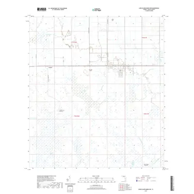
2018 Map of Long Island Marsh NW
USGS Topo · Published 2018About this map
The low-lying wetlands of DeSoto County dominate this 2018 survey, centered on the settlement of Joshua. This area is defined by a complex network of seasonal watercourses and marshes, including Joshua Creek and the meandering Honey Run. The landscape is dotted with hammocks—islands of hardwood trees amidst the wetter terrain—such as Turkey Hammock and Sour Orange Hammock. These features, along with Fourmile Island, suggest historical land use focused on cattle ranching and citrus, as indicated by the name Sour Orange Lake. Transport through this soggy environment is limited to straight-line corridors like the 4 Mile Grade Road, which cuts across the central wetlands. Further south, the map documents the drainage patterns of Tiger Bay Slough and Slippery Slough, providing a detailed look at the hydrology of the Florida interior before contemporary development.
Find a feature on this map
23 named features on this map. Tap any name to fly to it.
Don’t see what you’re looking for? This feature index may not catch every label — zoom into the map to look around manually.
Map Details
Editions of this 2018 Long Island Marsh NW Map
This is the sole edition of this map. No revisions or reprints were ever made.
Other maps of this area

1953 · Crewsville SE
USGS Topo · 1:24,000

1956 · Gardner
USGS Topo · 1:24,000

1956 · Arcadia SE
USGS Topo · 1:24,000

1956 · Crewsville SW
USGS Topo · 1:24,000

1956 · Long Island Marsh SW
USGS Topo · 1:24,000

1956 · Fort Pierce
USGS Topo · 1:250,000

1957 · Long Island Marsh NW
USGS Topo · 1:24,000

1957 · Long Island Marsh SE
USGS Topo · 1:24,000

1957 · Arcadia
USGS Topo · 1:24,000

1957 · Long Island Marsh NE
USGS Topo · 1:24,000