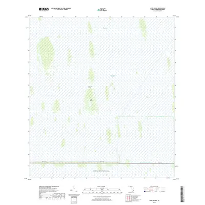
2018 Map of Long Island
USGS Topo · Published 2018About this map
The Everglades landscape dominates this section of southern Florida, where the expansive Shark River Slough flows toward the southwest. This 2018 survey reveals the delicate balance between the preserved wilderness of Everglades National Park and the engineering of the north, where Tamiami Canal Number C-4 runs parallel to the straight line of 8th St SW. The terrain is characterized by distinctive tree islands or hammocks, such as Long Island and Palm Tree Head, which rise slightly above the surrounding marshland. To the east, the Agricultural Canal and an area known as The Pocket mark the boundary where managed waterways meet the natural slough system, providing a clear view of the hydrological management required in Miami-Dade County.
Find a feature on this map
9 named features on this map. Tap any name to fly to it.
Don’t see what you’re looking for? This feature index may not catch every label — zoom into the map to look around manually.
Map Details
Editions of this 2018 Long Island Map
This is the sole edition of this map. No revisions or reprints were ever made.
Other maps of this area

1956 · Miami
USGS Topo · 1:250,000

1958 · Miami
USGS Topo · 1:250,000

1972 · Shark Valley Lookout Tower
USGS Topo · 1:24,000

1972 · Chekika Island
USGS Topo · 1:24,000

1972 · South Of Coopertown
USGS Topo · 1:24,000

1973 · Fortymile Bend
USGS Topo · 1:24,000

1973 · Custard Apple Hammock
USGS Topo · 1:24,000

1973 · West Of Pennsuco
USGS Topo · 1:24,000

1973 · Long Island
USGS Topo · 1:24,000
1973 · Coopertown
USGS Topo · 1:24,000