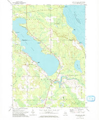
1971 Map of Long Lake East
USGS Topo · Published 1974About this map
Shorelines along Lake Huron and the eastern reaches of Long Lake define this 1971 study of the boundary between Presque Isle and Alpena counties. The landscape is a mix of protected timberland and industrial extraction, featuring the Black Lake State Forest and the Thunder Bay River State Forest alongside numerous Gravel Pits and the extensive Quarry works at Rockport. Small lakeside communities like Ashland and Lakewood dot the coast, while the interior shows signs of mid-century development including a Drive-in Theater and the Hinks Sch. Hydrological features include the McConnell Dam on Devils Lake and the Besser Natural Area near Bolton Point, preserving a stretch of the northern Michigan coast as it appeared before further modern expansion.
Find a feature on this map
50 named features on this map. Tap any name to fly to it.
Don’t see what you’re looking for? This feature index may not catch every label — zoom into the map to look around manually.
Map Details
Editions of this 1971 Long Lake East Map
This is the sole edition of this map. No revisions or reprints were ever made.
Other maps of this area

1954 · Alpena
USGS Topo · 1:250,000

1957 · Alpena
USGS Topo · 1:250,000

1958 · Alpena
USGS Topo · 1:250,000

1969 · Alpena
USGS Topo · 1:250,000

1971 · Lake Winyah
USGS Topo · 1:24,000
1971 · Presque Isle
USGS Topo · 1:24,000

1971 · Long Lake West
USGS Topo · 1:24,000

1971 · Alpena
USGS Topo · 1:24,000
1971 · Thompsons Harbor
USGS Topo · 1:24,000

1971 · Middle Island
USGS Topo · 1:24,000