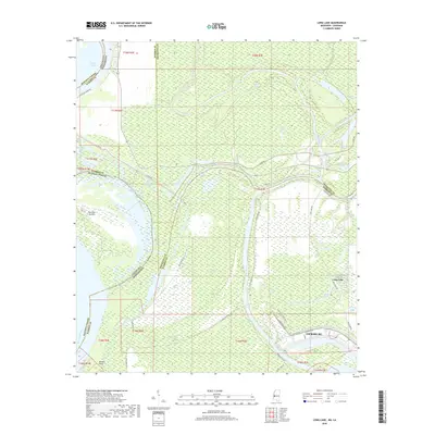
2018 Map of Long Lake
USGS Topo · Published 2018About this map
The Mississippi River and Yazoo River converge in this delta landscape, defining the western edge of Vicksburg and the state boundary with Louisiana. The terrain is a complex network of oxbow lakes, chutes, and bayous that tell the story of a shifting river system. Significant water bodies like Eagle Lake, Halpino Lake, and Long Lake dominate the lowlands, while the Old Channel and Paw Paw Chute indicate the historic paths of the great river.
Find a feature on this map
53 named features on this map. Tap any name to fly to it.
Don’t see what you’re looking for? This feature index may not catch every label — zoom into the map to look around manually.
Map Details
Editions of this 2018 Long Lake Map
This is the sole edition of this map. No revisions or reprints were ever made.
Other maps of this area

1909 · Millikens Bend
USGS Topo · 1:24,000

1909 · Mound
USGS Topo · 1:24,000

1910 · Mound
USGS Topo · 1:31,680

1918 · Vicksburg
USGS Topo · 1:62,500

1939 · Onward
USGS Topo · 1:62,500

1939 · Talla Bena
USGS Topo · 1:62,500

1939 · Alsatia
USGS Topo · 1:62,500

1941 · Vicksburg
USGS Topo · 1:62,500

1955 · Jackson
USGS Topo · 1:250,000

1961 · Jackson
USGS Topo · 1:250,000