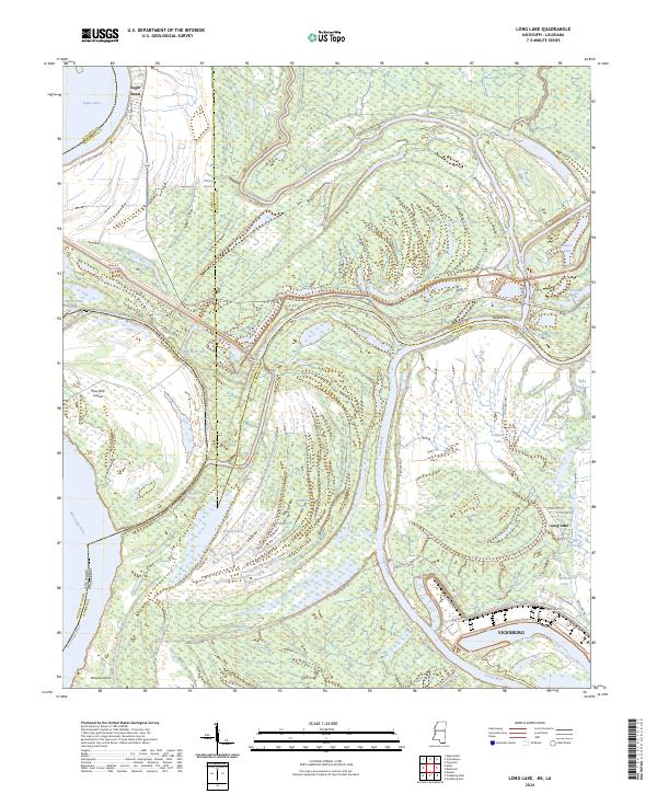
2024 Map of Long Lake
USGS Topo · Published 2024About this map
The Yazoo River and Mississippi River dominate this landscape north of Vicksburg, where the complex hydrology of the delta is visible through numerous oxbows and abandoned channels. The terrain is a network of bayous and lakes, including Eagle Lake and Long Lake, which define the boundaries between Warren, Issaquena, and Madison counties. Settlement patterns are sparse outside of the city, centered on locations like Eagle Bend and Sweets Ferry. Infrastructure follows the water, with Levee Rd protecting the interior and Kings Point Ferry Rd providing historical access points across the shifting river system. This map illustrates the intersection of heavy industry at the Vicksburg port, seen through labels like Port Terminal Cir and Industrial Dr, with the persistent marshlands and chutes that characterize this river-bottom environment.
Find a feature on this map
53 named features on this map. Tap any name to fly to it.
Don’t see what you’re looking for? This feature index may not catch every label — zoom into the map to look around manually.
Map Details
Editions of this 2024 Long Lake Map
This is the sole edition of this map. No revisions or reprints were ever made.
Other maps of this area

1909 · Millikens Bend
USGS Topo · 1:24,000

1909 · Mound
USGS Topo · 1:24,000

1910 · Mound
USGS Topo · 1:31,680

1918 · Vicksburg
USGS Topo · 1:62,500

1939 · Onward
USGS Topo · 1:62,500

1939 · Talla Bena
USGS Topo · 1:62,500

1939 · Alsatia
USGS Topo · 1:62,500

1941 · Vicksburg
USGS Topo · 1:62,500

1955 · Jackson
USGS Topo · 1:250,000

1961 · Jackson
USGS Topo · 1:250,000