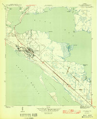
1944 Map of Long Point
USGS Topo · Published 1944About this map
Tyndall Field dominates this 1944 coastal landscape, established as a major military installation during the height of World War II. The facility's runways and support structures occupy a significant portion of the peninsula between East Bay and the Gulf of Mexico, illustrating the rapid wartime transformation of the Florida panhandle. Outside the military perimeter, the settlement of San Blas sits near the head of the peninsula, while the shoreline is defined by a complex network of coastal inlets including Pearl Bayou, Shoal Point Bayou, and Laird Bayou. The presence of Crooked Island shelters St Andrew Sound from the open sea, creating a protected waterway characteristic of this barrier island geography. This topographic survey captures the area just before significant post-war development, emphasizing the intersection of military defense and the natural maritime environment.
Find a feature on this map
21 named features on this map. Tap any name to fly to it.
Don’t see what you’re looking for? This feature index may not catch every label — zoom into the map to look around manually.
Map Details
Editions of this 1944 Long Point Map
3 editions found
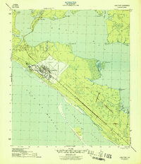
Other maps of this area

1943 · Beacon Beach
USGS Topo · 1:31,680

1943 · Panama City
USGS Topo · 1:31,680

1943 · Crooked Island
USGS Topo · 1:31,680

1944 · Beacon Hill
USGS Topo · 1:31,680

1944 · Long Point
USGS Topo · 1:31,680

1945 · Allanton
USGS Topo · 1:31,680

1945 · North Of Allanton
USGS Topo · 1:31,680
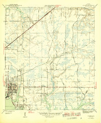
1945 · Parker
USGS Topo · 1:31,680

1947 · Allanton
USGS Topo · 1:25,000

1949 · Apalachicola
USGS Topo · 1:250,000