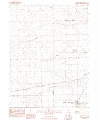
1983 Map of Long Point
USGS Topo · Published 1984About this map
Ancona and Long Point anchor this northern Illinois landscape, where the flat agricultural plains of Livingston and La Salle Counties are dissected by Eagle Creek and Moon Creek. This 1983 provisional survey highlights a transition in land use, from the traditional agrarian network of Osage and Reading townships to specialized infrastructure like the Ancona Gas Storage Field. A notable military installation, the USAF Dewline Training Center, appears near the center of the sheet, marking the era's Cold War training requirements. The Atchison Topeka and Santa Fe railroad cuts a diagonal path through the terrain, connecting small settlements like Garfield and Leeds. Local history is preserved in the location of the Annunciation Ch and the Township Hall, providing essential landmarks for genealogists tracing family roots in these rural communities.
Find a feature on this map
21 named features on this map. Tap any name to fly to it.
Don’t see what you’re looking for? This feature index may not catch every label — zoom into the map to look around manually.
Map Details
Editions of this 1983 Long Point Map
This is the sole edition of this map. No revisions or reprints were ever made.
Other maps of this area

1925 · Streator
USGS Topo · 1:62,500

1927 · Streator
USGS Topo · 1:62,500

1934 · Wenona
USGS Topo · 1:48,000

1939 · Wenona
USGS Topo · 1:62,500

1955 · Minonk
USGS Topo · 1:62,500

1958 · Flanagan
USGS Topo · 1:62,500

1958 · Aurora
USGS Topo · 1:250,000

1958 · Peoria
USGS Topo · 1:250,000

1961 · Aurora
USGS Topo · 1:250,000

1961 · Peoria
USGS Topo · 1:250,000