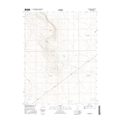
2017 Map of Long Ridge
USGS Topo · Published 2017About this map
Long Ridge dominates the western half of this Millard County landscape, a prominent topographic spine that defines the local drainage patterns. The arid terrain is marked by a series of critical water management features, reflecting the essential nature of irrigation and stock watering in this high desert environment. Strategic water sources such as the Deseret Reservoirs and Construction Reservoir are positioned along the eastern slopes, while the Styler Reservoir and Pony Express Reservoir serve the southwest. Transportation across this portion of the Sevier Desert is facilitated by the Ipp Main Rd, which cuts diagonally toward the northern reaches of Sevier Lake. The southeastern corner of the quadrangle shows the infrastructure for larger-scale water storage with Sevier Lake Reservoir Number 5 and Sevier Lake Reservoir Number 6, highlighting the region's managed hydrology near the terminal basin of the Sevier River.
Find a feature on this map
14 named features on this map. Tap any name to fly to it.
Don’t see what you’re looking for? This feature index may not catch every label — zoom into the map to look around manually.
Map Details
Editions of this 2017 Long Ridge Map
This is the sole edition of this map. No revisions or reprints were ever made.
Other maps of this area

1885 · Sevier Desert
USGS Topo · 1:250,000

1908 · Fish Springs
USGS Topo · 1:250,000

1910 · Fish Springs
USGS Topo · 1:250,000

1953 · Delta
USGS Topo · 1:250,000

1958 · Delta
USGS Topo · 1:250,000

1962 · Delta
USGS Topo · 1:250,000

1971 · Red Pass
USGS Topo · 1:24,000

1971 · Clay Knoll
USGS Topo · 1:24,000

1971 · Rocky Knoll
USGS Topo · 1:24,000

1972 · Whirlwind Valley SW
USGS Topo · 1:24,000