
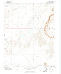
1971 Map of Rocky Knoll
USGS Topo · Published 1974About this map
The Old Channel Sevier River winds through the desert landscape of Millard County in the early 1970s, revealing a complex network of seasonal water management and natural hydrology. This arid terrain is defined by its depressions and Sand Dunes, where water sources like Rocky Knoll Spring and Soda Spring provided critical points of relief. The presence of numerous Borrow Pits and various reservoirs, including Tamarack Reservoir and Hardpan Reservoir, suggests the ongoing efforts to capture and redirect the scarce water of Soap Wash for regional needs. A lone Corral near the river channel and a scattered system of wells, such as the Soda Well, indicate the area's use for livestock and land management. The map documents the intricate balance between the desert's natural features and the infrastructure required to sustain activity in this part of the Great Basin.
Find a feature on this map
17 named features on this map. Tap any name to fly to it.
Don’t see what you’re looking for? This feature index may not catch every label — zoom into the map to look around manually.
Map Details
Editions of this 1971 Rocky Knoll Map
This is the sole edition of this map. No revisions or reprints were ever made.
Other maps of this area

1885 · Sevier Desert
USGS Topo · 1:250,000

1908 · Fish Springs
USGS Topo · 1:250,000

1910 · Fish Springs
USGS Topo · 1:250,000

1953 · Delta
USGS Topo · 1:250,000

1958 · Delta
USGS Topo · 1:250,000

1962 · Delta
USGS Topo · 1:250,000

1971 · Red Pass
USGS Topo · 1:24,000

1971 · Clay Knoll
USGS Topo · 1:24,000

1971 · Neels
USGS Topo · 1:24,000
1971 · Pot Mountain
USGS Topo · 1:24,000