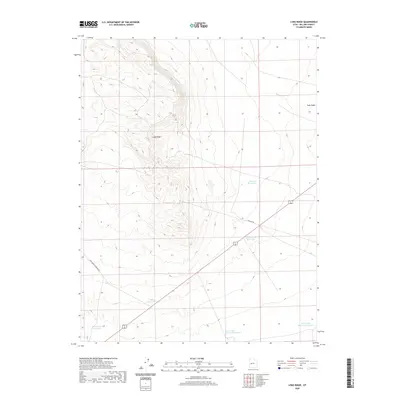
2020 Map of Long Ridge
USGS Topo · Published 2020About this map
Long Ridge dominates the western half of this Millard County landscape, defining the local topography with a series of drainages and elevation shifts. The area is heavily defined by its water management infrastructure, featuring a network of named catchment sites such as the Styler Reservoir and the Deseret Reservoirs. In the southern reaches, the Sevier Lake Reservoir Number 5 and Sevier Lake Reservoir Number 6 sit along the margin of the Sevier Lake basin, reflecting the critical role of irrigation and water storage in this arid Utah environment. Transportation across this portion of the Great Basin is facilitated by routes like Ipp Main Rd, which cuts across the terrain near the Construction Reservoir. The map provides a detailed view of the land before any further modern development, showing the proximity of the Soap Wash and the Pony Express Reservoir to the ridge line.
Find a feature on this map
11 named features on this map. Tap any name to fly to it.
Don’t see what you’re looking for? This feature index may not catch every label — zoom into the map to look around manually.
Map Details
Editions of this 2020 Long Ridge Map
This is the sole edition of this map. No revisions or reprints were ever made.
Other maps of this area

1885 · Sevier Desert
USGS Topo · 1:250,000

1908 · Fish Springs
USGS Topo · 1:250,000

1910 · Fish Springs
USGS Topo · 1:250,000

1953 · Delta
USGS Topo · 1:250,000

1958 · Delta
USGS Topo · 1:250,000

1962 · Delta
USGS Topo · 1:250,000

1971 · Red Pass
USGS Topo · 1:24,000

1971 · Clay Knoll
USGS Topo · 1:24,000

1971 · Rocky Knoll
USGS Topo · 1:24,000

1972 · Whirlwind Valley SW
USGS Topo · 1:24,000