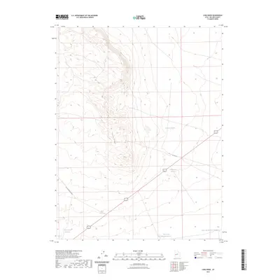
2023 Map of Long Ridge
USGS Topo · Published 2023About this map
Long Ridge provides the central geographic spine for this area of Millard County, defining a landscape marked by essential water management for the arid terrain. The map documents a network of named catchment systems including the Deseret Reservoirs, Construction Reservoir, and the Styler Reservoir along the western slopes. These features reflect the long-standing efforts to capture and store seasonal runoff in a region where water is the primary driver of land use and utility. Transport across this high desert environment is facilitated by the Ipp Main Rd and the Long Ridge Reservoir Rd, which connect the scattered reservoirs. Near the southern edge, the map identifies Sevier Lake Reservoir Number 5 and Sevier Lake Reservoir Number 6, part of a series of developments linked to the drainage towards the Sevier Lake basin. Historically minded researchers can trace the modern utility corridors and water infrastructure that sustain this specific corner of the Utah desert.
Find a feature on this map
9 named features on this map. Tap any name to fly to it.
Don’t see what you’re looking for? This feature index may not catch every label — zoom into the map to look around manually.
Map Details
Editions of this 2023 Long Ridge Map
This is the sole edition of this map. No revisions or reprints were ever made.
Other maps of this area

1885 · Sevier Desert
USGS Topo · 1:250,000

1908 · Fish Springs
USGS Topo · 1:250,000

1910 · Fish Springs
USGS Topo · 1:250,000

1953 · Delta
USGS Topo · 1:250,000

1958 · Delta
USGS Topo · 1:250,000

1962 · Delta
USGS Topo · 1:250,000

1971 · Red Pass
USGS Topo · 1:24,000

1971 · Clay Knoll
USGS Topo · 1:24,000

1971 · Rocky Knoll
USGS Topo · 1:24,000

1972 · Whirlwind Valley SW
USGS Topo · 1:24,000