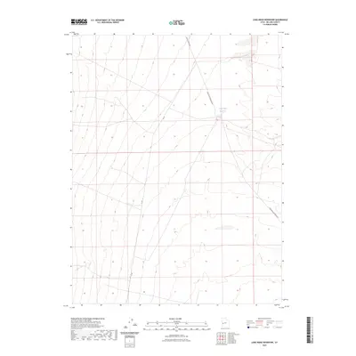
2023 Map of Long Ridge Reservoir
USGS Topo · Published 2023About this map
Long Ridge Reservoir anchors this sparsely settled landscape in Millard County, serving as a critical water management point in an arid basin. The map reveals a network of utilitarian backcountry routes, including Death Canyon Rd and 3c Rd, which navigate the subtle contours of the terrain. The infrastructure of the area is defined by the Long Ridge Reservoir Rd, which provides access to the central water feature. This survey documents the intersection of public lands and livestock management resources, illustrating how water access dictates the movement and activity across this high-desert environment in the early 21st century.
Find a feature on this map
4 named features on this map. Tap any name to fly to it.
Don’t see what you’re looking for? This feature index may not catch every label — zoom into the map to look around manually.
Map Details
Editions of this 2023 Long Ridge Reservoir Map
This is the sole edition of this map. No revisions or reprints were ever made.
Other maps of this area

1908 · Fish Springs
USGS Topo · 1:250,000

1910 · Fish Springs
USGS Topo · 1:250,000

1953 · Delta
USGS Topo · 1:250,000

1958 · Delta
USGS Topo · 1:250,000

1960 · Notch Peak
USGS Topo · 1:62,500

1962 · Delta
USGS Topo · 1:250,000

1972 · Whirlwind Valley SW
USGS Topo · 1:24,000
1972 · Long Ridge
USGS Topo · 1:24,000

1972 · Long Ridge Reservoir
USGS Topo · 1:24,000
1972 · Marjum Pass
USGS Topo · 1:24,000