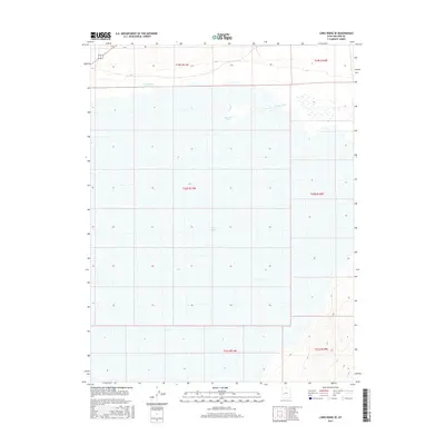
2017 Map of Long Ridge SE
USGS Topo · Published 2017About this map
Sevier Lake dominates this arid landscape in central Utah, where the terminal basin collects the remnants of the Sevier River as it flows from the northeast. This 2017 survey shows the intricate grid of the Public Land Survey System across the dry lake bed, including township and range lines for t19s r11w and t20s r11w. The terrain is characterized by the flat expanse of the basin and the more varied topography of the Long Ridge to the east. The Stage Road Reservoir in the northern portion of the map provides a rare water source and waypoint in this otherwise sparse desert environment, suggesting the historical routes and land management practices required to navigate the western edge of the Sevier Desert.
Find a feature on this map
9 named features on this map. Tap any name to fly to it.
Don’t see what you’re looking for? This feature index may not catch every label — zoom into the map to look around manually.
Map Details
Editions of this 2017 Long Ridge SE Map
This is the sole edition of this map. No revisions or reprints were ever made.
Other maps of this area

1885 · Beaver
USGS Topo · 1:250,000

1885 · Sevier Desert
USGS Topo · 1:250,000

1908 · Fish Springs
USGS Topo · 1:250,000

1910 · Fish Springs
USGS Topo · 1:250,000

1953 · Richfield
USGS Topo · 1:250,000

1953 · Delta
USGS Topo · 1:250,000

1958 · Richfield
USGS Topo · 1:250,000

1958 · Delta
USGS Topo · 1:250,000

1962 · Delta
USGS Topo · 1:250,000

1971 · Red Pass
USGS Topo · 1:24,000