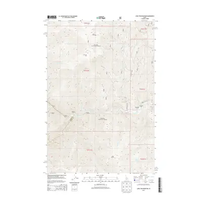
2013 Map of Long Tom Mountain
USGS Topo · Published 2013About this map
The confluence of the Salmon River and the Middle Fork Salmon River serves as the focal point of this wilderness survey, highlighting the dramatic elevation shifts within the Salmon National Forest. The map documents the point where the Idaho Co Lemhi Co line meets the riverbanks, marking a boundary in this steep river-carved landscape. Notable topographic landmarks include the high peaks of Long Tom Mtn and the extended Long Tom Ridge to the north, while the southern reaches feature the curiously named Horse Heaven. For those researching local travel and recreation, the survey identifies several river-access points such as the Middle Fork Trailhead, Stoddard Bridge, and Long Tom Rapids. Established sites for wilderness camping are noted at Ebenezer Bar Campground, Long Tom Campground, and Middle Fork Campground, providing a record of 21st-century public land usage and backcountry infrastructure.
Find a feature on this map
25 named features on this map. Tap any name to fly to it.
Don’t see what you’re looking for? This feature index may not catch every label — zoom into the map to look around manually.
Map Details
Editions of this 2013 Long Tom Mountain Map
This is the sole edition of this map. No revisions or reprints were ever made.
Other maps of this area

1950 · Blackbird Mtn
USGS Topo · 1:62,500

1951 · Blackbird Mtn
USGS Topo · 1:62,500

1956 · Elk City
USGS Topo · 1:250,000

1960 · Elk City
USGS Topo · 1:250,000

1960 · Shoup
USGS Topo · 1:62,500

1962 · Square Top
USGS Topo · 1:24,000

1962 · Long Tom Mtn
USGS Topo · 1:24,000

1962 · Aggipah Mtn
USGS Topo · 1:24,000

1962 · Mt Mc Guire
USGS Topo · 1:24,000

1962 · Horse Creek Butte
USGS Topo · 1:24,000