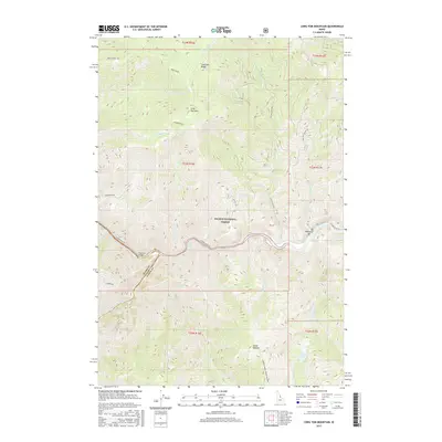
2017 Map of Long Tom Mountain
USGS Topo · Published 2017About this map
Salmon National Forest encompasses the high country and river canyons documented in this survey, defined by the meeting of the Salmon River and the Middle Fork Salmon River. The terrain is characterized by steep elevation changes between peaks like Long Tom Mtn and the deep river valleys below. Human presence is sparse and largely concentrated near the water, with Stoddard Bridge providing a critical crossing point and the settlement of Stoddard established nearby. The map illustrates the specialized navigation of this era, marking the Long Tom Rapids as a significant river feature. Forest roads such as Colson Creek Rd and Salmon River Rd snake through the drainage basins of Cramer Basin and Bear Basin, providing access to high-altitude landmarks like Bear Camp Spring and the secluded Dome Lake.
Find a feature on this map
35 named features on this map. Tap any name to fly to it.
Don’t see what you’re looking for? This feature index may not catch every label — zoom into the map to look around manually.
Map Details
Editions of this 2017 Long Tom Mountain Map
This is the sole edition of this map. No revisions or reprints were ever made.
Other maps of this area

1950 · Blackbird Mtn
USGS Topo · 1:62,500

1951 · Blackbird Mtn
USGS Topo · 1:62,500

1956 · Elk City
USGS Topo · 1:250,000

1960 · Elk City
USGS Topo · 1:250,000

1960 · Shoup
USGS Topo · 1:62,500

1962 · Square Top
USGS Topo · 1:24,000

1962 · Long Tom Mtn
USGS Topo · 1:24,000

1962 · Aggipah Mtn
USGS Topo · 1:24,000

1962 · Mt Mc Guire
USGS Topo · 1:24,000

1962 · Horse Creek Butte
USGS Topo · 1:24,000