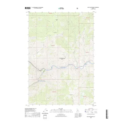
2020 Map of Long Tom Mountain
USGS Topo · Published 2020About this map
Salmon National Forest dominates this Central Idaho landscape, where the confluence of the Salmon Wild and Scenic River and the Middle Fork Salmon Wild and Scenic River forms a critical junction for river travel and drainage. This 2020 survey highlights the remote riverfront locations of Stoddard and Ebenezer Bar, sites intrinsically linked to the canyon floor. High above the water, the terrain ascends sharply toward Long Tom Mtn and the high plateaus of Horse Heaven.
Find a feature on this map
41 named features on this map. Tap any name to fly to it.
Don’t see what you’re looking for? This feature index may not catch every label — zoom into the map to look around manually.
Map Details
Editions of this 2020 Long Tom Mountain Map
This is the sole edition of this map. No revisions or reprints were ever made.
Other maps of this area

1950 · Blackbird Mtn
USGS Topo · 1:62,500

1951 · Blackbird Mtn
USGS Topo · 1:62,500

1956 · Elk City
USGS Topo · 1:250,000

1960 · Elk City
USGS Topo · 1:250,000

1960 · Shoup
USGS Topo · 1:62,500

1962 · Square Top
USGS Topo · 1:24,000

1962 · Long Tom Mtn
USGS Topo · 1:24,000

1962 · Aggipah Mtn
USGS Topo · 1:24,000

1962 · Mt Mc Guire
USGS Topo · 1:24,000

1962 · Horse Creek Butte
USGS Topo · 1:24,000