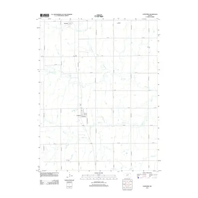
2012 Map of Longford
USGS Topo · Published 2012About this map
Longford serves as a central point of this agricultural landscape in Clay County, where the street grid of Main St and Kansas Ave defines the small settlement. The surrounding terrain is heavily influenced by the drainage patterns of Chapman Cr and its tributary, W Chapman Cr, which wind through the northern sections, while Badger Cr and Basket Cr cross the southern reaches. This modern survey reflects a persistent rural structure, anchored by several community burial grounds including Swanwood Cem and Rose Meron Cem. To the north, the small community of Oak Hill sits near the headwaters of the local creek systems. The land is precisely divided by a network of rural roads such as Deer Trail Rd and Frontier Rd, illustrating the enduring section-line grid that has organized Kansas farming for generations.
Find a feature on this map
40 named features on this map. Tap any name to fly to it.
Don’t see what you’re looking for? This feature index may not catch every label — zoom into the map to look around manually.
Map Details
Editions of this 2012 Longford Map
This is the sole edition of this map. No revisions or reprints were ever made.
Other maps of this area

1891 · Clay Center
USGS Topo · 1:125,000

1955 · Manhattan
USGS Topo · 1:250,000

1956 · Manhattan
USGS Topo · 1:250,000

1957 · Manhattan
USGS Topo · 1:250,000
1964 · Industry
USGS Topo · 1:24,000
1964 · Buckeye
USGS Topo · 1:24,000

1964 · Clay Center SW
USGS Topo · 1:24,000

1964 · Idana
USGS Topo · 1:24,000

1964 · Miltonvale
USGS Topo · 1:24,000
1965 · Manchester NW
USGS Topo · 1:24,000