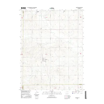
2016 Map of Longford
USGS Topo · Published 2016About this map
Longford and Oak Hill anchor this rural landscape in western Clay County, where the grid of sectional roads intersects a rolling drainage system. The settlement of Longford is detailed with its core street plan, including Main St, Durham St, and Santfe Ave, reflecting its historical alignment with regional transport. To the north, Oak Hill sits near the confluence of local tributaries, while the surrounding countryside is marked by several small family and community burial grounds that provide significant value for genealogical research.
Find a feature on this map
53 named features on this map. Tap any name to fly to it.
Don’t see what you’re looking for? This feature index may not catch every label — zoom into the map to look around manually.
Map Details
Editions of this 2016 Longford Map
This is the sole edition of this map. No revisions or reprints were ever made.
Other maps of this area

1891 · Clay Center
USGS Topo · 1:125,000

1955 · Manhattan
USGS Topo · 1:250,000

1956 · Manhattan
USGS Topo · 1:250,000

1957 · Manhattan
USGS Topo · 1:250,000
1964 · Industry
USGS Topo · 1:24,000
1964 · Buckeye
USGS Topo · 1:24,000

1964 · Clay Center SW
USGS Topo · 1:24,000

1964 · Idana
USGS Topo · 1:24,000

1964 · Miltonvale
USGS Topo · 1:24,000
1965 · Manchester NW
USGS Topo · 1:24,000