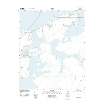
2012 Map of Longtown
USGS Topo · Published 2012About this map
Eufaula Lake dominates this landscape, its sprawling bays and inlets defining the geography of eastern Oklahoma in the early 21st century. The map centers on Longtown, where a dense network of residential streets like Lakeview Dr and Circle Dr meets the shoreline. This area serves as a primary hub for lakefront living and recreation, evidenced by the presence of Arrowhead Airport to the southwest and several named housing developments such as Morrison Acres, Eldorado, and Chickasha.
Find a feature on this map
70 named features on this map. Tap any name to fly to it.
Don’t see what you’re looking for? This feature index may not catch every label — zoom into the map to look around manually.
Map Details
Editions of this 2012 Longtown Map
This is the sole edition of this map. No revisions or reprints were ever made.
Other maps of this area

1900 · Sansbois
USGS Topo · 1:125,000

1900 · Canadian
USGS Topo · 1:125,000

1909 · Sans Bois
USGS Topo · 1:125,000

1911 · Sansbois
USGS Topo · 1:125,000

1946 · Fort Smith
USGS Topo · 1:250,000

1963 · Stidham
USGS Topo · 1:24,000

1963 · Eufaula
USGS Topo · 1:24,000

1963 · Texanna
USGS Topo · 1:24,000

1965 · Fort Smith
USGS Topo · 1:250,000

1967 · Fort Smith
USGS Topo · 1:250,000