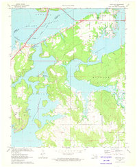
1971 Map of Longtown
USGS Topo · Published 1972About this map
Eufaula Reservoir dominates this 1971 topographical study, illustrating the transformation of the Canadian River valley into a major recreation and water management hub. The sprawling reservoir inundates the landscape between Pittsburg and McIntosh counties, leaving only the highest elevations of the Quinton terrain as islands and peninsulas. Along the eastern shores, the settlement of Longtown serves as a gateway to the water, while the Missouri - Kansas - Texas railroad corridor traces the western edge near the submerged riverbed.
Find a feature on this map
23 named features on this map. Tap any name to fly to it.
Don’t see what you’re looking for? This feature index may not catch every label — zoom into the map to look around manually.
Map Details
Editions of this 1971 Longtown Map
This is the sole edition of this map. No revisions or reprints were ever made.
Other maps of this area

1900 · Sansbois
USGS Topo · 1:125,000

1900 · Canadian
USGS Topo · 1:125,000

1909 · Sans Bois
USGS Topo · 1:125,000

1911 · Sansbois
USGS Topo · 1:125,000

1946 · Fort Smith
USGS Topo · 1:250,000

1963 · Stidham
USGS Topo · 1:24,000

1963 · Eufaula
USGS Topo · 1:24,000

1963 · Texanna
USGS Topo · 1:24,000

1965 · Fort Smith
USGS Topo · 1:250,000

1967 · Fort Smith
USGS Topo · 1:250,000