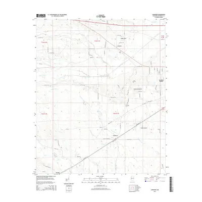
2015 Map of Longview
USGS Topo · Published 2015About this map
Longview and its surrounding communities in Oktibbeha County are defined by a complex network of creeks that carve through the landscape west of Starkville. Numerous waterways, including Talking Warrior Cr, Trim Cane Cr, and Chinchahoma Cr, dictate the placement of roads and homesteads. The map highlights established rural hubs like Adaton and Bradley, alongside residential developments such as Oakwood Estates and Westland Heights. Genealogists will find particular value in the documentation of local burial sites, ranging from the prominent Adaton Cem and New Hope Cem to the isolated Lost Cem. The settlement pattern follows a traditional Southern rural layout, where clusters of homes and churches like New Hope Church Rd anchor the intersections between older corridors like Old Highway 12 and more modern routes like Highway 82.
Find a feature on this map
71 named features on this map. Tap any name to fly to it.
Don’t see what you’re looking for? This feature index may not catch every label — zoom into the map to look around manually.
Map Details
Editions of this 2015 Longview Map
This is the sole edition of this map. No revisions or reprints were ever made.
Other maps of this area

1953 · West Point
USGS Topo · 1:250,000

1958 · West Point
USGS Topo · 1:250,000

1959 · Pheba
USGS Topo · 1:62,500

1963 · West Point
USGS Topo · 1:250,000

1965 · Starkville
USGS Topo · 1:24,000

1965 · Bluff Lake
USGS Topo · 1:24,000

1965 · Longview
USGS Topo · 1:24,000

1965 · Bradley
USGS Topo · 1:24,000

1972 · Maben
USGS Topo · 1:24,000

1972 · Double Springs
USGS Topo · 1:24,000