2024 Map of Longview
USGS Topo · Published 2024About this map
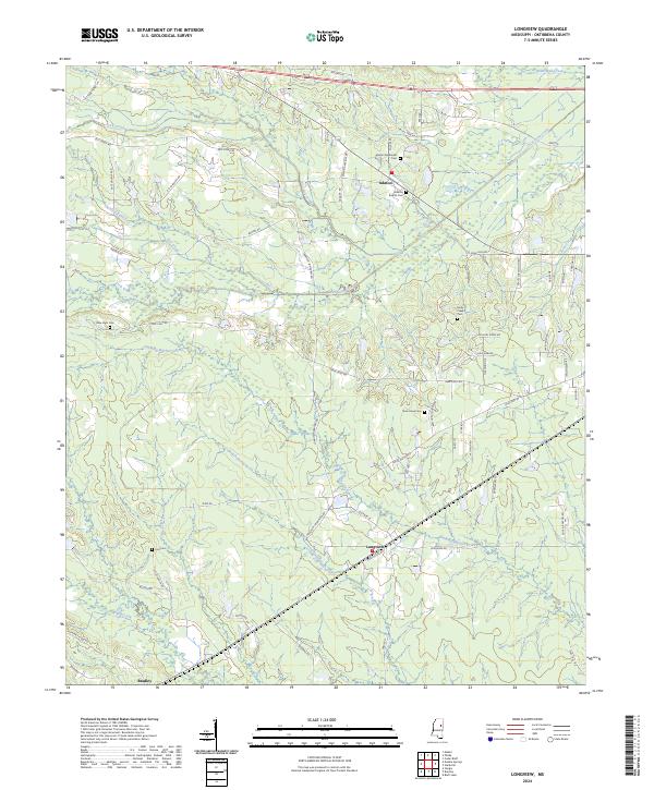
Longview and Adaton center this portrait of rural Oktibbeha County, where the landscape is defined by a dense network of creek drainages and community-focused landmarks. The map details a transition from the structured plots of the north to the protected wetlands of the Sam D Hamilton Noxubee National Wildlife Refuge in the southeast. Numerous small burial grounds, including the remote Lost Cemetery and the Josey Creek Cemetery, suggest long-established family ties to the land near Talking Warrior Creek and Chinchahoma Creek. The infrastructure follows the natural flow of the terrain, with local routes like New Light Road and Old Highway 12 connecting dispersed homes and historic church sites. To the south, the settlement of Bradley sits at the edge of the wilderness, marking the boundary between agricultural use and the expansive conservation areas managed for wildlife.
Find a feature on this map
74 named features on this map. Tap any name to fly to it.
Don’t see what you’re looking for? This feature index may not catch every label — zoom into the map to look around manually.
Map Details
Editions of this 2024 Longview Map
This is the sole edition of this map. No revisions or reprints were ever made.