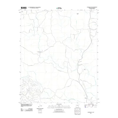
2011 Map of Lonsdale NE
USGS Topo · Published 2011About this map
Rubicon anchors the southeastern corner of this landscape, situated along the confluence of roads that navigate the complex topography of Saline County. The area is defined by the convergence of the Middle Fork Saline River and the Alum Fork Saline River, which carve through the terrain beneath the heights of Prillman Ridge. Family and community history is preserved at Bolin Cemetery in the northwest, Wesleys Chapel Cemetery near the center, and Guerin Cemetery to the east, marking the legacy of long-standing rural settlements.
Find a feature on this map
42 named features on this map. Tap any name to fly to it.
Don’t see what you’re looking for? This feature index may not catch every label — zoom into the map to look around manually.
Map Details
Editions of this 2011 Lonsdale NE Map
This is the sole edition of this map. No revisions or reprints were ever made.
Other maps of this area

1890 · Benton
USGS Topo · 1:125,000

1894 · Benton
USGS Topo · 1:125,000

1938 · Benton
USGS Topo · 1:48,000

1944 · Benton
USGS Topo · 1:62,500

1955 · Little Rock
USGS Topo · 1:250,000

1956 · Little Rock
USGS Topo · 1:250,000

1960 · Little Rock
USGS Topo · 1:250,000

1963 · Paron SW
USGS Topo · 1:24,000

1963 · Fourche SW
USGS Topo · 1:24,000

1963 · Paron
USGS Topo · 1:24,000